UAV LiDAR: Drone Scanning and Airborne Laser Scanning
What is UAV LiDAR?
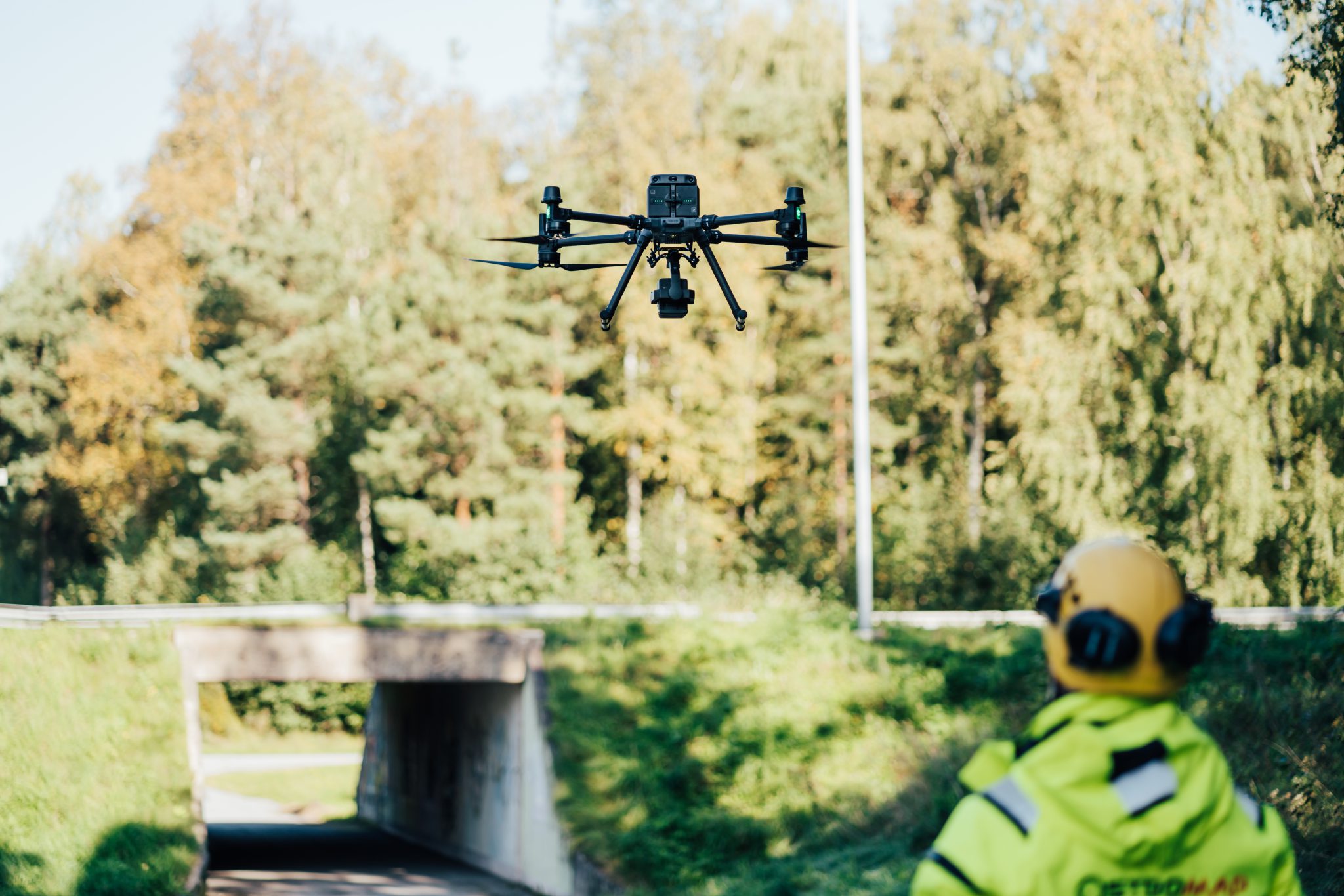
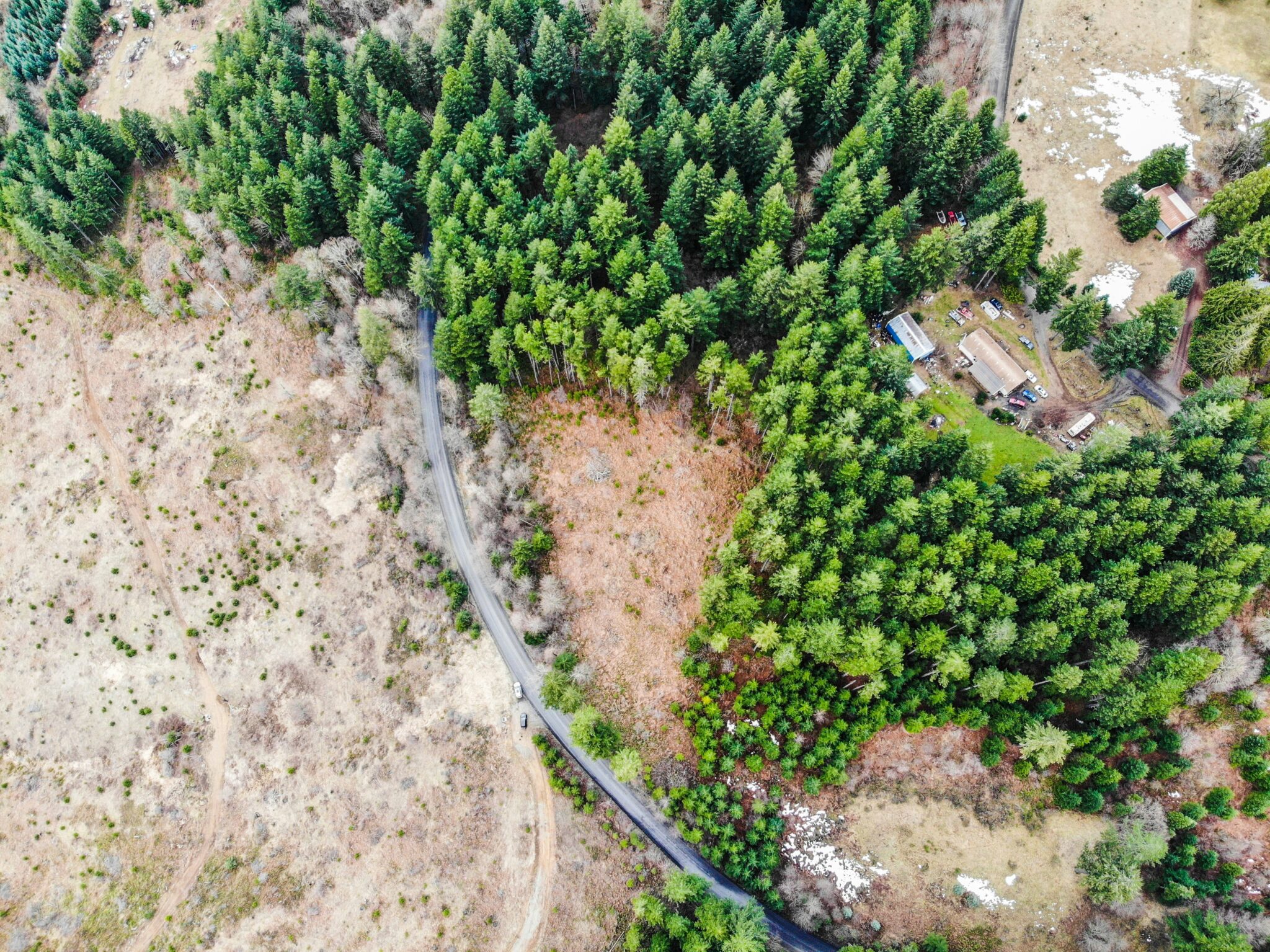
UAVs (Unmanned Aerial Vehicles), commonly known as drones, are widely used in surveying to quickly and efficiently collect data from above. When equipped with a LiDAR sensor (Light Detection and Ranging), drones use laser pulses to measure distances and generate highly accurate 3D models and maps of terrain, buildings, and objects. Unlike traditional drone photography, LiDAR can penetrate vegetation layers and provide precise information even in areas that are difficult to access or measure from the ground.
The combination of UAV and LiDAR is known as UAV LiDAR or airborne laser scanning. This method is fast, safe, and cost-effective, performing equally well in dense forests as in large-scale infrastructure and construction projects. At Ostromap, we are specialists in UAV LiDAR and airborne laser scanning. Our team has extensive experience turning real-world environments into precise, usable data—whether for volume calculations, digital terrain models (DTMs), planning material, or detailed documentation.
Applications of UAV LiDAR
- Mapping terrain and creating 3D models and digital terrain models (DTM)
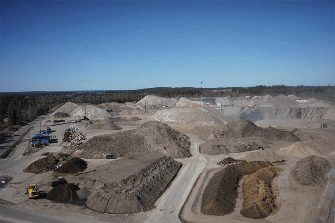
- Volume calculations for construction and mining projects.
- Planning and documentation in infrastructure projects.
- Site and construction monitoring
At Ostromap, we help our clients leverage drone photography and drone
Advantages of Airborne Laser Scanning (UAV LiDAR)
UAV LiDAR combines the flexibility of drone photography technology with the precision of LiDAR, offering a range of benefits compared to traditional surveying methods. Some of the key advantages of airborne laser scanning (UAV LiDAR) include:
- Rapid data collection: large areas can be surveyed in a single day
- High accuracy: producing reliable 3D models and point clouds for planning, volume calculations, and documentation
- Safe measurement in hard-to-reach or hazardous environments
- Detailed building and terrain maps: providing a solid foundation for architecture, construction, and planning
- Cost-effective surveying: reducing the need for ground personnel and physical inspections
Industries and Areas We Serve with UAV LiDAR
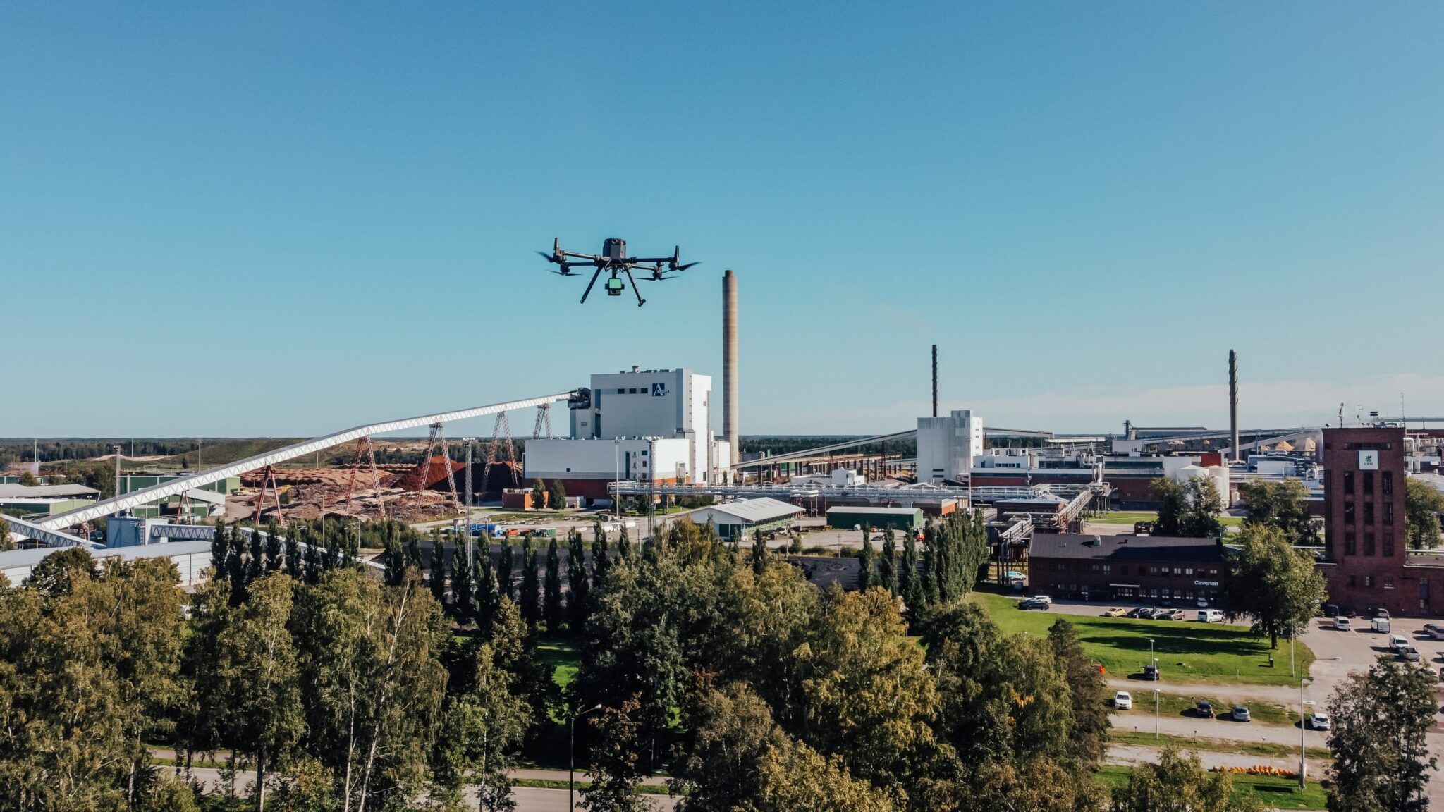
We carry out UAV LiDAR and drone laser scanning projects across the entire Nordic region, offering tailored solutions for a wide range of industries and project areas. Examples of industries and applications:
- Agriculture and forestry
- Construction and infrastructure projects
- Nature conservation and environmental management
- Forest management and resource monitoring
- Maintenance of solar energy facilities
- Public organizations and government agencies
- Land-use planning and development
- Inspection of grid and distribution systems
Reduce Costs and Increase Efficiency and Reliability with Our Drone Scanning Services
Our drone scanning services enable fast, safe, and cost-effective mapping of buildings, infrastructure, terrain, and natural environments, providing a reliable foundation for planning, construction, and monitoring. All data is processed using specialized software to deliver the exact product the client needs.
We support projects at every stage¾from planning and design, through construction, to long-term management. Whether it’s residential developments, infrastructure, industrial sites, or energy and forestry projects, our UAV LiDAR and drone scanning services provide data that helps you plan smarter, build faster, and monitor projects with high precision.
Examples of products and deliverables we offer:
- High-density point cloud files
- 3D surface models and models of buildings, facilities, or terrain
- Digital elevation models with color shading and contour lines
- Georeferenced orthomosaic images
- Volume and quantity calculations
- Documentation of project progress and work phases
- Mapping of undisturbed natural areas for detailed planning according to client requirements
- Surface and digital terrain models for planning purposes
- BIM / intelligent 3D models
- Digital twins
Our UAV LiDAR and Airborne Laser Scanning Services
At Ostromap, we combine extensive experience with the latest UAV LiDAR and airborne laser scanning technology to carry out surveying projects across the entire Nordic region. We always tailor our drone scanning services to the client’s needs both the mission itself and the delivered product providing a reliable and accurate foundation for planning, monitoring, and decision-making.
Digital Terrain and Surface Models
DSM (Digital Surface Model) and DTM (Digital Terrain Model) for analyzing terrain, ground levels, and elevation differences.
3D Models and Building Models
2D and 3D models of buildings, facilities, landscapes, or entire areas.
Volume and Quantity Calculations
Reports for earthworks, material volumes, stockpiles, or natural resources.
Digital Twins and BIM Integration
Complete 3D representations of objects, buildings, or areas that can be used throughout the project lifecycle.
Common Questions About UAV LiDAR, Airborne Laser Scanning, and Drone Laser Scanning
What UAV LiDAR services do we offer? What are the benefits of UAV LiDAR? We answer some of the questions you may have but if you don’t find what you’re looking for here, please feel free to contact us!
What UAV/LiDAR services do we provide?
At Ostromap, we offer comprehensive UAV LiDAR and airborne laser scanning services, with solutions tailored to each client and project. Using the latest drone scanning technology and advanced LiDAR sensors, we collect precise and reliable data for customers across the entire Nordic region. Our services include point cloud collection and processing, creation of 3D surface models, digital elevation models (DTM/DSM), georeferenced orthomosaics, volume calculations, as well as 2D and 3D models of buildings, facilities, and landscapes.
We always deliver data in the format that best suits the client’s needs, making it possible to use the results for planning, project monitoring, resource management, and visualization. With our UAV LiDAR and drone scanning services, you gain cost-effective, reliable, and accurate information that supports decision-making and streamlines projects across all industries.
How accurate is UAV LiDAR or drone laser scanning compared to traditional surveying methods?
Drone laser scanning with UAVs and LiDAR provides highly accurate geospatial data with centimeter-level precision. Compared to traditional ground surveying, UAV LiDAR allows for faster data collection with minimal impact on the area, while maintaining the accuracy required for design, construction projects, and asset management.
With UAV LiDAR and drone laser scanning, large or hard-to-reach areas can be surveyed in a short time, delivering cost-effectiveness, safety, and reliability, along with detailed and dependable information for all types of projects.
How cost-effective and efficient is UAV LiDAR or drone laser scanning compared to traditional methods?
Drone laser scanning with UAVs and LiDAR reduces the need for multiple site visits and manual measurements, saving both time and labor costs. This surveying technology allows for rapid data collection over large areas, including hard-to-reach or hazardous locations, streamlining decision-making and ensuring reliable results.
Is UAV LiDAR always a better option than traditional surveying methods?
Not always, but airborne laser scanning offers significant advantages in terms of time and resources. Tasks that might take days or weeks using conventional methods can often be completed in just a few hours with UAV LiDAR and drone laser scanning.
Benefits of airborne laser scanning:
- Safer data collection – hard-to-reach or hazardous areas can be surveyed without putting personnel at risk.
- Minimal impact on the site – work can be carried out on active construction sites or sensitive environments with little disruption.
- Frequent monitoring – enables regular measurements and improved data support for decision-making throughout the project.
- Detailed and comprehensive mapping – large areas can be surveyed accurately in a short amount of time.
Can Ostromap provide tailored services?
Absolutely. At Ostromap, we always tailor our UAV LiDAR and drone laser scanning services to meet the client’s needs, including custom-designed flight paths that consider project goals, site conditions, and preferred delivery formats. We also offer recurring surveys and long-term monitoring to ensure you always have up-to-date and reliable data throughout the project lifecycle.
Ready to take your project to new heights? Contact us!

Henrik Aho
Sales and development manager
henrik.aho@ostromap.fi
050 490 2087

Fredrik Fagerholm
Department manager – Machine control
fredrik.fagerholm@ostromap.fi
044 726 6577