Construction and Infrastructure Surveying
Your Expert in Construction Surveying and Infrastructure Surveying
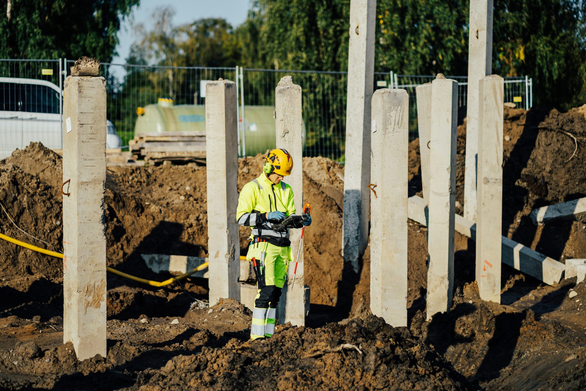
At Ostromap, we are experts in construction surveying and infrastructure surveying, providing reliable surveying services for everything from industrial buildings and residential projects to roads and bridges across the Nordic region. Our experienced survey consultants carry out stakeouts, survey measurements, and verification surveys at all project stages, from planning and design to completion and documentation.
By combining modern total station and GNSS technology with our extensive experience, we ensure that every project is executed efficiently, accurately, and in accordance with applicable standards. We take responsibility for the entire process, from control networks and design documentation to final reporting and quality assurance, ensuring that every step is performed with precision.
Construction Surveying and Infrastructure Surveying: Reliability at Every Project Stage
Our services in construction and infrastructure surveying include:
- Control networks
- Surveying and setting out of buildings and infrastructure
- Terrain models in the form of digital terrain models
- UAV mapping and 3D modeling
- Laser- and GNSS-based measurements
- Verification and follow-up surveys
- Quantity and volume calculations for earthworks, asphalt, and concrete
- Design surveys and modeling for machine control systems
- Documentation and quality assurance of survey data
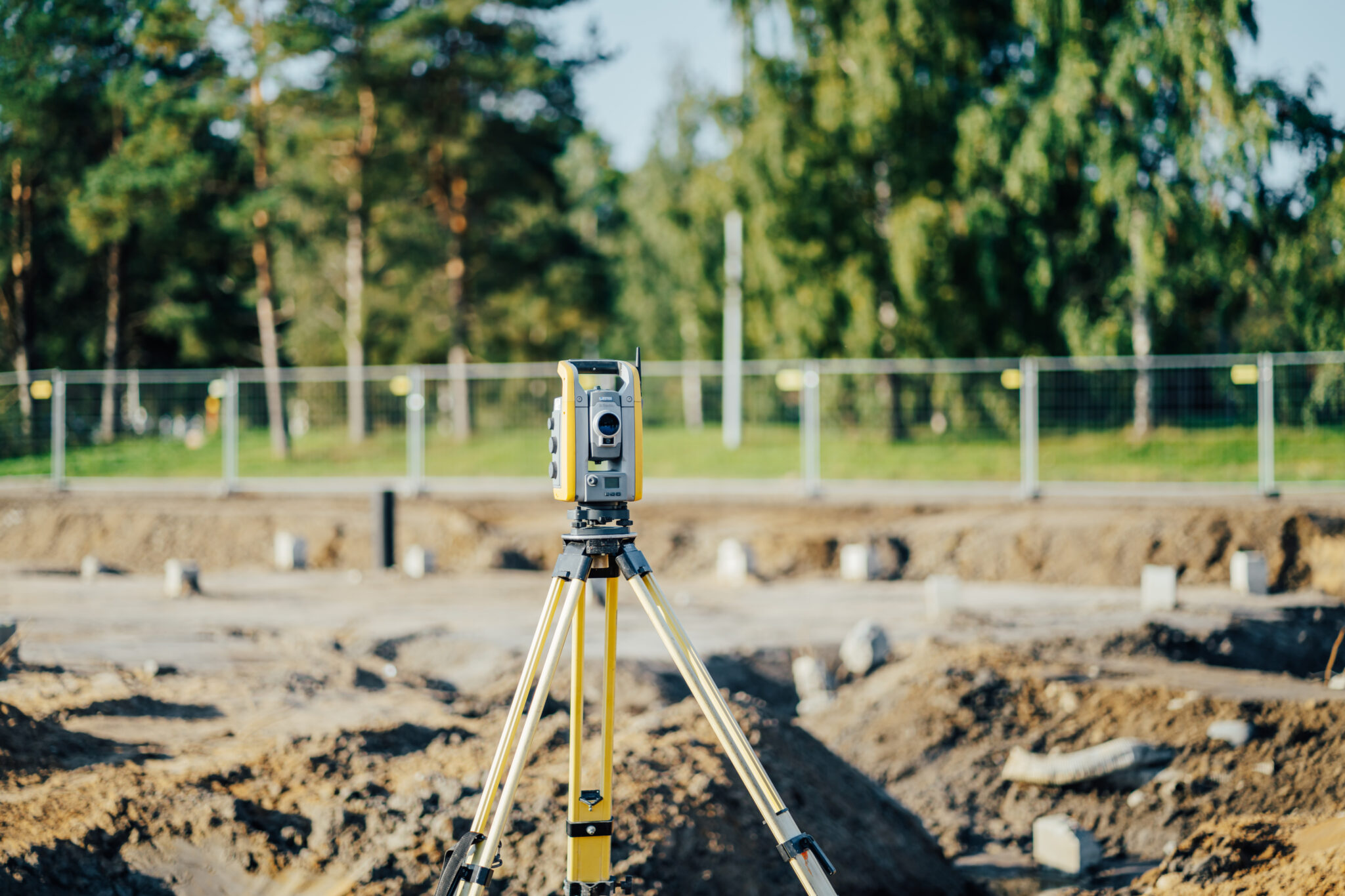
Project measurement: a secure basis for construction and civil engineering projects
When planning new roads, bridges and tunnels, for example, design measurements are crucial to obtaining an accurate overview of the subsoil and surroundings. Through carefully performed measurements, we can deliver reliable input values that facilitate quick and efficient decisions in the construction and production process.
Design measurements give planners, architects and construction contractors a reliable starting point, which makes it easier to plan further and reduce risks in the project. The measurements include existing roads, buildings and municipal engineering and are carried out in the desired coordinate system.
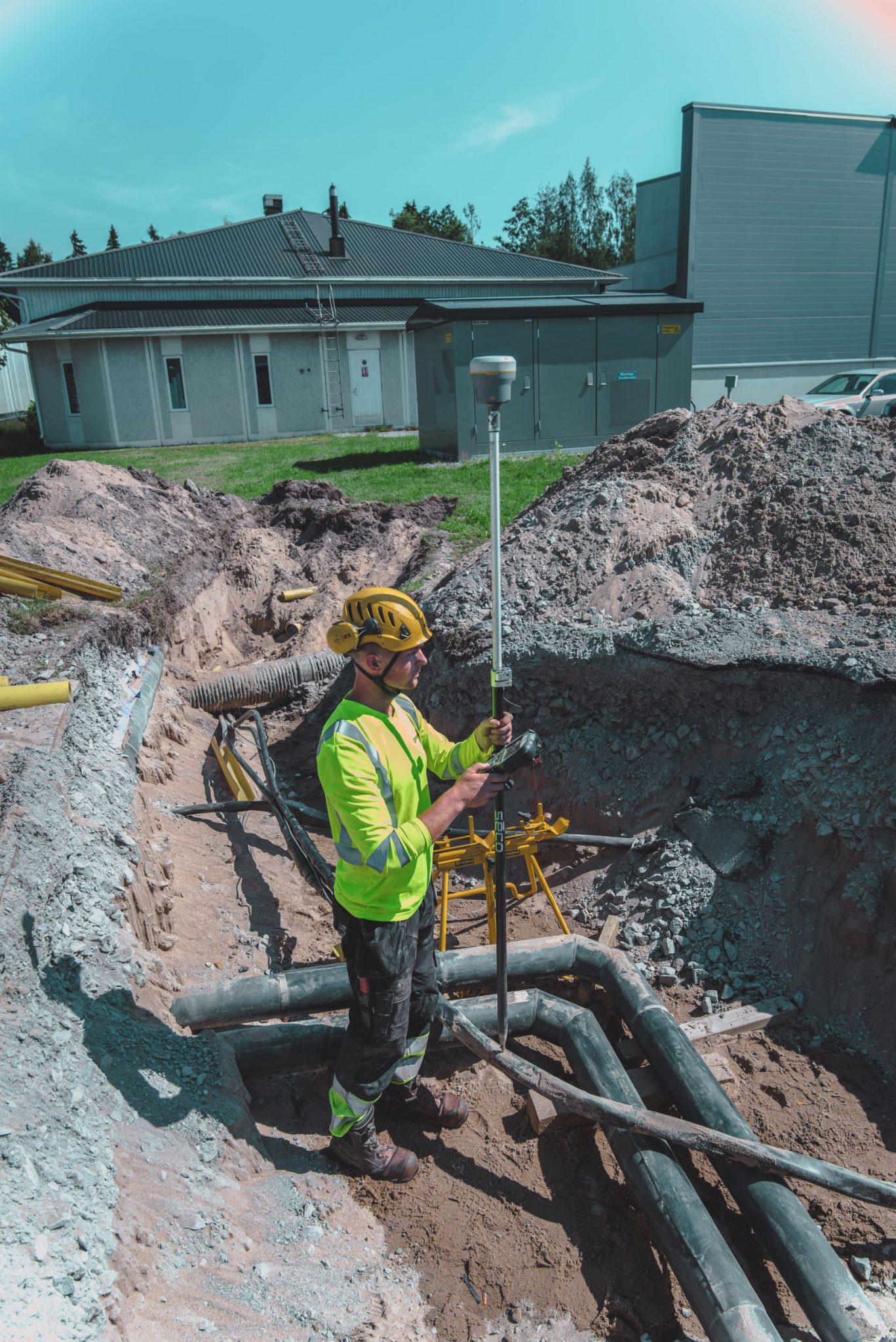
Kartläggning och lednings-dokumentation
Mapping is a crucial step to obtain an accurate and reliable overview of terrain, existing utilities, and other infrastructure before any groundwork begins. At Ostromap, we carry out surveys of both existing and new utility lines, municipal infrastructure, and other ground installations using GPS technology, providing precise data for planning and design.
As part of the mapping process, we also offer utility documentation, where existing cables and pipes are identified and recorded to minimize risks during excavation or trenching work. Clients can choose their preferred format for the documentation.
How We Have Supported Our Clients with Construction Surveying and Infrastructure Surveying
Our surveying services in construction surveying, infrastructure surveying, mapping, and site measurements provide clients with a reliable foundation for every step of the construction process. Below are some examples of our client projects in construction surveying, infrastructure surveying, and mapping:
Common Questions About Construction Surveying, Infrastructure Surveying, and Other Surveying Services
Here we answer questions you may have about our surveying services in construction and infrastructure projects. Feel free to contact us if you want to learn more about our services!
What construction surveying and infrastructure surveying services do we provide?
Here we answer questions you may have about our surveying services in construction and infrastructure projects. Feel free to contact us if you want to learn more about our services!
What construction surveying and infrastructure surveying services do we provide?
At Ostromap, we offer a comprehensive range of construction surveying and infrastructure surveying services for projects of all sizes. Our services include:
- Surveying and setting out of buildings, structures, and installations
- Verification surveys of roads, bridges, tunnels, and other infrastructure
- Design surveying to create accurate data for planning and construction
- Mapping of land, terrain, and existing infrastructure
- Site measurements to document completed work and ensure precision
- Industrial surveying for production facilities and technical installations
- Settlement surveys and follow-up measurements to monitor ground and building movements
- Documentation and delivery of survey data in digital formats for continued project use
What equipment does Ostromap use for construction surveying and infrastructure surveying?
We use modern equipment for all types of construction surveying and infrastructure surveying. Our primary tools are total stations and GNSS receivers, enabling us to perform precise measurements, setting out, and verification surveys. With this equipment, we can document and monitor projects from start to finish, from design documentation and control networks to completed construction, ensuring that all measurements are carried out with the highest accuracy and in compliance with applicable standards.
How do our surveying services support planning and execution of construction and infrastructure projects?
Our surveying services in construction, infrastructure, mapping, and site measurements facilitate project planning and execution by providing accurate and reliable data from the very beginning. Precise measurements and setting out minimize the risk of errors, delays, and additional costs, while enabling more efficient project planning.
In what regions do we provide construction surveying and infrastructure surveying?
Ostromap is headquartered in Jakobstad, Finland, with offices at several other locations across the country. We provide construction surveying and infrastructure surveying services throughout Finland and also in other Nordic countries.
How can Ostromap assist with industrial surveying?
We provide industrial surveying for production facilities and technical installations. Through precise measurements, verification surveys, and follow-ups, we can document machinery, storage areas, piping systems, and other equipment, making installation, maintenance, and renovations more efficient.
How can Ostromap help you with design surveying?
We assist customers with design surveying by creating a reliable data foundation for planning and designing construction and infrastructure projects. Using GPS, total stations, or drones, we measure terrain, existing buildings, roads, installations, and other infrastructure, providing a comprehensive overview that supports decision-making and project planning. The result is accurate input data that planners, architects, and contractors can use to plan and execute projects efficiently.
Interested in our surveying services? Contact us!

Henrik Aho
Sales and development manager
henrik.aho@ostromap.fi
050 490 2087

Kim Tuorila
Department manager – Vaasa
kim.tuorila@ostromap.fi
044 322 6678

Andre Hagman
Department manager – Pietarsaari
andre.hagman@ostromap.fi
044 745 3237